

Can I plan a multiple-stop delivery route using Google Maps?
Google Maps is a well-established route planning tool. It is used by people all over the world to plan trips, locate stores and businesses, get a look at where they are going before they start a journey, and to figure out where they are along the way. One of the world’s leading map apps, Google Maps uses its deep pool of locational and other data to provide detailed results for web and mobile users. The app can even help travelers select the shortest route between two locations, calculate estimated travel times, and avoid traffic congestion.
Some delivery teams use Google Maps to plan their local routes. But is Google Maps the right choice for your business?
In this article, you’ll find step-by-step instructions for how to use Google Maps to plan last-mile deliveries. We’ll also dig into why Google Maps might not deliver everything you need when it comes to managing your delivery routes efficiently.
Emin Younan
November 11, 2020
Can I plan a multiple-stop delivery route using Google Maps?
We see this question a lot, particularly among small businesses just getting started making local or last-mile deliveries. The short answer is yes. You can plan a delivery route that includes more than one stop using Google Maps.
Google Maps’ free route planning service enables drivers to enter several stops or waypoints to create a multi-stop route. Google Maps’ algorithm uses a database of geolocation data and takes into account real-time traffic information to determine the shortest distance for each leg of your trip. The route is displayed on your map as you create it, and you can change the order of your stops to test different routes before you start driving.
Routes can be planned using Google Maps’ mobile or web app and shared via text or email.
When you create a multi-stop route using Google Maps, you get
Close estimates of the mileage and travel time for each leg of your route and the entire route
Accurate (in most cases) location data for each destination using latitude and longitude coordinates
Multiple display options, including a street view that shows an address and its surrounding environment, that can help drivers locate their stops when traveling an unfamiliar route
Up-to-date roadway and traffic information that helps you avoid detours and delays
An easy, drag and drop method to visualize and modify your routes during the planning process
Step-by-step driving directions, including turn-by-turn voice directions, to guide your couriers through each leg of the journey
The ability to transfer a route from your desktop to directly your mobile device or via an email or text link1
Should you use Google Maps to plan your multi-stop delivery routes?
Answering that question is more complicated. Google Maps’ can be useful for planning routes. However, it isn’t a fully-functional route optimization tool.
But, before we dig into what Google Maps’ doesn’t do, let’s look at how you can use it to create and save a multi-stop delivery route.
Your step-by-step guide to planning a multi-stop delivery route using Google Maps
You can create your route using either Google Maps’ web-based app or the mobile app. Access Google Maps online by going to Google Maps or visit the Google Play or Apple iOS stores and download the app on your mobile device. If you decide to enter your delivery stops using the Google Maps website, you can send the route to your mobile device later.
Here’s how to plan a route:2
1. Select the route planning tool in Google Maps.
Open the app or go to the webpage and select the Directions icon. This is Google Maps’ route planning tool.
2. Select your route type.
Before you begin entering your stops, select the Car icon to indicate that you will be planning a route using roadways.
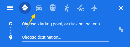
3. Enter your starting point.
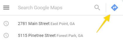
You can enter a starting point by selecting a location on the map or typing in an address.
Note: If you are keying in (or copying and pasting an address), you also need to select the search icon that appears next to the address that you have entered. You won’t see the destination’s map pin displayed on the map until you activate the search.
Once you have entered a starting point, you will see its location displayed on your map.
Planning tips: Google Maps allows you to enter up to 10 stops or waypoints on a single route in addition to your starting point. You can gain an 11th destination by not including your depot or pickup point from the route and starting with the first address to which your driver will need directions istead.
If you exclude the pick up point from a route, make sure you communicate this fact to your drivers. Do the same if you expect your drivers to return to a home base that isn’t included in their directions following the completion of their route. And, remember to still include any stem miles you haven’t routed in your mileage and time calculations.
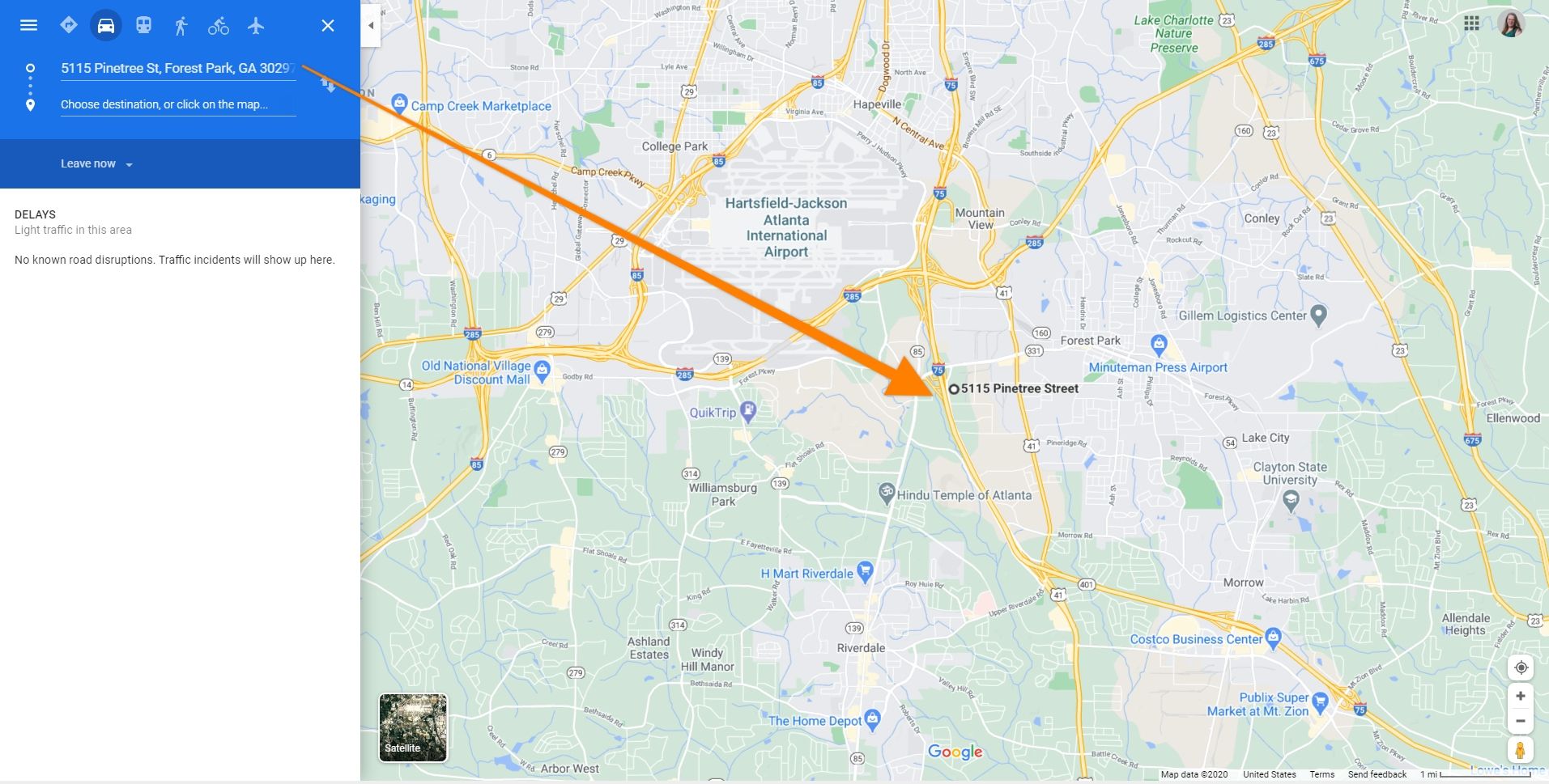
4. Enter the address for each stop on your intended route.
To add a destination, type or paste its address onto the destination line in the route planning tool. Then, select search. If the location can be found, a map pin (or bullseye) will appear to indicate the searched address’s location on your map.
To add another address, select the Add icon and repeat the entry and search process.
Note: Be sure to check each destination address against your master list before accepting the route. Google Maps uses stored data about businesses and an auto-complete feature to manage information which may misdirect you on rare occasions.
Planning tips: Google Maps doesn’t provide an option for entering addresses in bulk. So you’ll have to type or paste each address into the app manually each time you need to create a new route. Prepare your list of stops in advance using a spreadsheet or other format that makes it easy for you to copy and paste the information into the Google Maps Directions search bar.
Also, pre-sort your destinations using zip codes, geographic zones, driver availability or other characteristics to make it easier to group them into 10-stop batches. For example, if you have 20 stops with the same zip code, you might want to create two,10-stop routes for those stops and assign them both to the same driver.
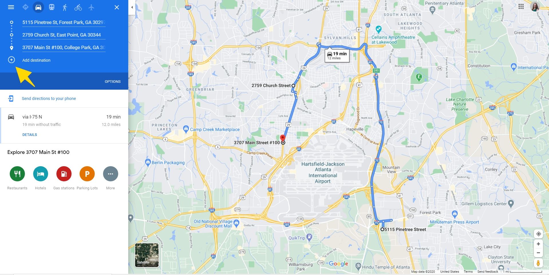
5. Manually adjust your route.
Google Maps will use roadway data plus real-time traffic information to choose the best way for you to travel between each point on your delivery route. But, the app doesn’t calculate how to avoid backtracking and extra mileage over the entire route. You should manually change the order of your stops to eliminate any obvious inefficiencies. You can do this by grabbing addresses and dragging to a different position in the route’s sequence.
Note: When you use your mouse to grab an address, the cursor should change to a hand and three dots will appear next to the selected address. Don’t attempt to change the order of your stops by moving the location’s map pin on the map display. Moving the pin will change the associated stop’s address.
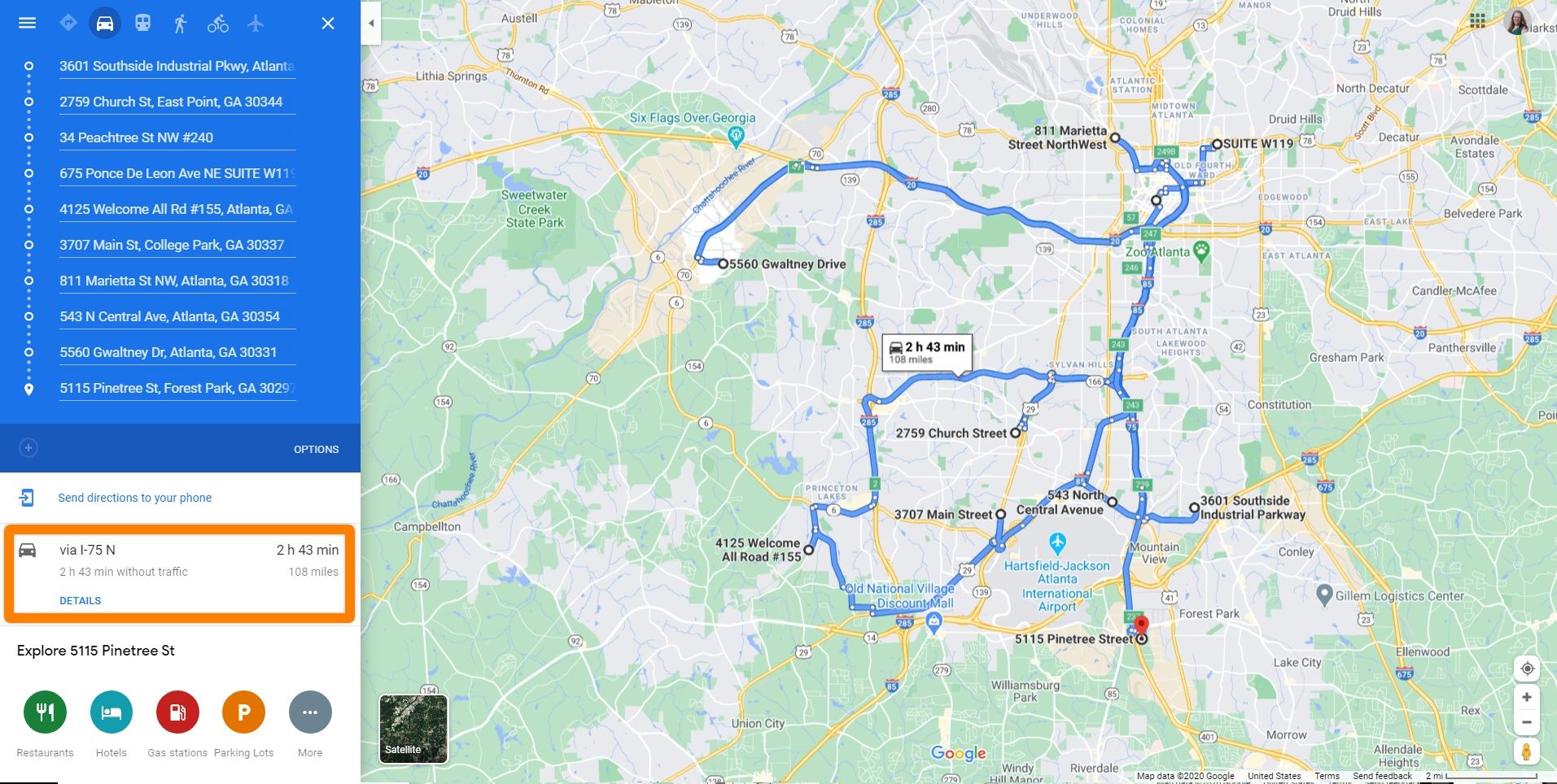
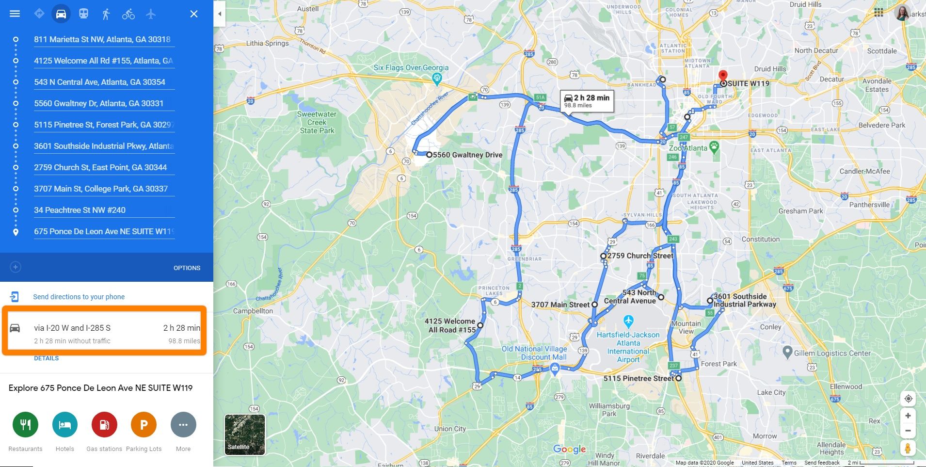
After you’ve dragged it to a new location in the queue, the route’s appearance on your map will change and the time and mileage data for the route will update.
Planning tip: Attempting to adjust your routes to save time and fuel can be time-consuming. (We’ll explain more about that later.) Keep your total costs in mind and don’t spend too much of your valuable time trying to optimize your routes manually using Google Maps. Focus on the obvious problems that can be fixed quickly.
6. Send your route to your or your driver’s mobile phone and save it.
Saving your Google Maps route isn’t intuitive. There is no “save” button that you can click. Instead, you will need to use one or more strategies to transfer and preserve your route.
If you are using the web app to create your route, the easiest way to save your route data for your own use is to copy the link for the map displaying the route.
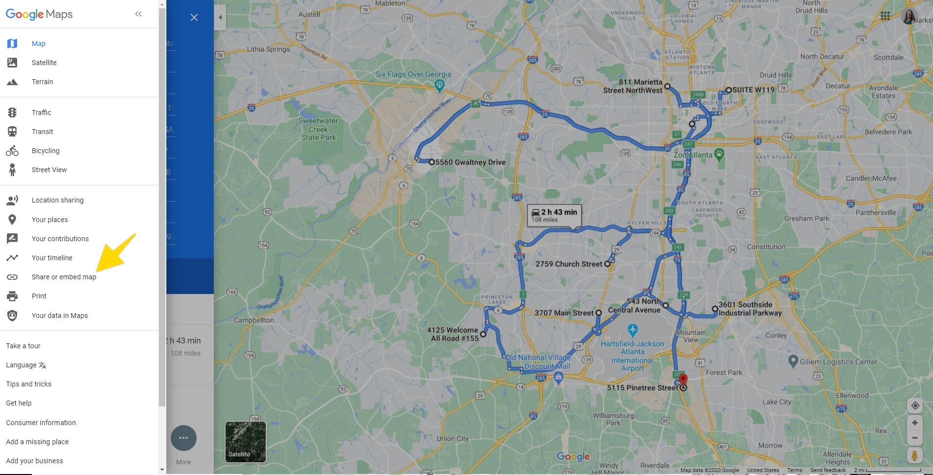
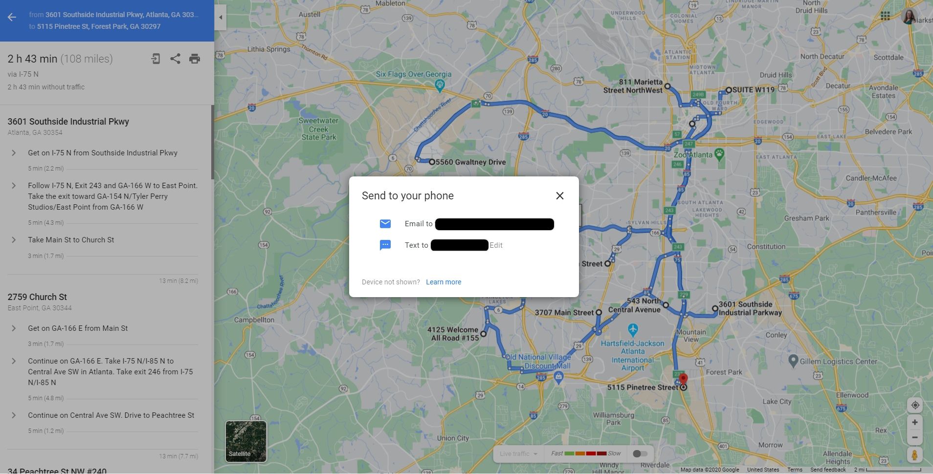
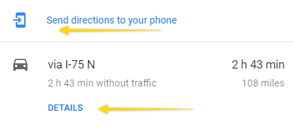
You can also send the route from the web app to your mobile device via email or text. To send the route to someone else, copy the link and send it to them by email or text. You’ll find the necessary menu choices under the “Send directions to your phone” and “DETAILS” buttons on your directions panel.
On your mobile device, share your route by choosing the share option from the right side menu (represented by three dots).3
Productivity tip: Don’t forget to send yourself that finalized route link and save it to a spreadsheet or other location before you leave your map! If you are creating a recurring route, be sure to save your ordered list of addresses in case you need to re-enter them.
Now that you know what you can do with Google Maps and how to do it. Let’s look at what Google Maps can’t handle.
What Google Maps doesn’t deliver
Google Maps is a definite step up from planning routes using non-dynamic maps or pen and paper, but it’s not the best solution for every delivery business.
Google Maps is a route planning optimization
Route planning versus route optimization
What’s the difference between planning a route to reach a set of destinations and optimizing that route?
When you add your stops to Google Maps and begin experimenting with different delivery sequences by changing the order of those stops, you are considering some of your options. Route optimization involves considering all your options, including relevant variables such as vehicle capacities, delivery windows and driver availability. All of these factors influence how much it costs you to make each delivery and your profitability.
But, evaluating every option--even for a route with just a few stops and limited variables--is difficult and very time-consuming.
Businesses have been trying to crack route optimization, also known as the Traveling Salesman Problem (TSP), for a very long time. The reason it takes more than just a map to solve it is that the number of possible routes grows exponentially with every added stop.
If you listed every possible combination of stops for a single-vehicle route with just 10 destinations, your list would include 362,880 options. There are 2,432,902,008,176,640,000 possible alternatives for a route that includes 20 stops.4 No one has time to sort through all those choices.
Now, imagine having to consider all of the stops and divide them among several vehicles and drivers, plus arrange for specific stops to be made during limited delivery windows. These situations are called Vehicle Routing Problems (VRPs) and they make the TPS look like a walk in the park.
From vehicle capacity to delivery windows, every variable that you add to your routing problem increases its complexity.
Route optimization requires more than a good map
As a routing tool for businesses that make multi-stop deliveries, Google Maps comes up short. It isn’t made to do the computational heavy lifting required for route optimization. Google Maps can help you see where you are going, but it can’t help you reduce the costs of getting there.
First, because it isn’t really intended for commercial use, you can’t plan for more than 10 or 11 stops at a time.
Additionally, the algorithm doesn’t automatically select the best order of stops for your entire route. Instead, it computes the best path to get from one point on your route to the next. It doesn’t solve the TSP.
Google Maps doesn’t help solve the VRP, either. You cannot use Google Maps to visualize or experiment with distributing stops between multiple vehicles. You’ll have to sort out any variances such as assigned drivers, vehicles, delivery windows or vehicle capacities before you decide which stops to place on a single vehicle’s route.
Take a step beyond Google Maps and try a route optimization tool built for doing business
Each step in your logistics chain has an impact on your customer’s satisfaction and your bottom line. If you are making more than 10 deliveries or spending more than 15 minutes on route planning a day, you may have outgrown Google Maps.
You can learn more about what you can do to keep your costs down and deliver each parcel on time in our article, How route optimization can increase your margins. Then, when you’re ready to experience the difference fully-optimized routes can make to your performance, give our optimization solution a try. It’s free for 7 days and you don’t need to enter a credit card.
Let us show you how route optimization can make the last mile easier.
2.
Note: these steps and accompanying image feature the web-based version of Google MapsStay connected
